Cathedral Beach Picnic Area
Yosemite Valley
WELCOME TO YOSEMITEME!
WHAT TO DO
PICNICKING
With very little planning, you can travel to almost anywhere in Yosemite and find a picnic destination, especially during the summer. This could be true even if it means sitting in your car at a shady turn-off, or a peaceful parking area surrounded by impressive views. Being in Yosemite alone captivates and inspires in many different ways. Add a relaxing place to stop to eat a prepared meal and few experiences can exceed this in relaxation.
If you prefer a few more amenities to smooth your picnic along, however, such as a restroom, trash/recycling disposal, picnic tables, and water, then you can stop at one of the 13 designated picnic sites in the Park. Details about the 13 sites are grouped below based on their location in the Park: 1. Yosemite Valley, 2. Tioga Road, 3. Highway 41 (Wawona Road), and 4. Highway 140 (El Portal Road).
Curry Village, Yosemite Valley
Value for Price
Skill Level
Supplies Needed
YOSEMITE VALLEY PICNICKING

Accessibility


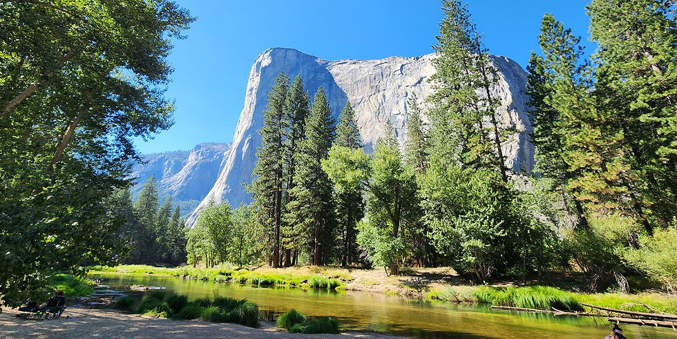
CATHEDRAL BEACH PICNIC AREA

WHAT:
Highlights: Cathedral Beach can be reached off of Southside Drive in Yosemite Valley shortly after passing Bridalveil Fall viewing area. Dramatic views of El Capitan make this an iconic spot to photograph this famous granite monolith. Situated along the Merced River, the sandy shoreline provides ample spots to lay down a blanket and to use that as a home base for swimming activities. Most of the picnic tables are shaded providing a relief from the summer heat. This tranquil spot especially inspires during the evening when sunsets bring a glow to El Capitan amidst striking shadows from the surrounding trees.
Lowlights: Its popularity may produce crowds and it accommodates fewer picnickers (although, as mentioned above, a blanket can serve as a resting spot on the sandy shore of the Merced). Still, being the first picnic area available while driving into the Valley, it may be bypassed by those seeking to be near the heart of Yosemite Village Welcome Center. Consequently, sites may be found more easily here than in other picnic areas.
WHEN: Open year-round from dawn to dusk.
WHERE: On the left of Southside Drive going east. See MAP above.
HOW MUCH: No charge with Park Entrance Fee.

SENTINEL BEACH PICNIC AREA

WHAT:
Highlights: Sentinel Beach is the second picnic area accessible when driving into Yosemite Valley along Southside Drive. Similar to Cathedral Beach, it sits along the Merced River and provides a long sandy shoreline to lay down a blanket and take in the sun while listening to the relaxing sounds of the river. Mid to late summer allows for swimming along the shoreline. Pack plenty of snacks and lunch and make a day of it here at this site. It is some distance from Southside drive allowing for a peaceful and tranquil spot away from the crowds. A clear view of Sentinel Peak can be seen from the shoreline.
Sentinel Beach might be one of the best options when other Park sites become overcrowded since it can be easily bypassed for more popular spots.
Lowlights: Crowds can be a factor, but the shoreline allows for plenty of space to share among picnickers.
WHEN: Open year-round from dawn to dusk.
WHERE: After passing Cathedral Beach Picnic area on the left of Southside Drive going east. See MAP above.
HOW MUCH: No charge with Park Entrance Fee.

SWINGING BRIDGE PICNIC AREA

WHAT:
Highlights: The Swinging Bridge Picnic Area ranks as the most popular of all of Yosemite’s picnic areas and is the third one in on Southside Drive while driving toward Yosemite Village. It accommodates more people with 14 grills matched with 14 tables all adequately separated from one another and shaded by the tall conifers. It contains 35+ parking spots. Its nearness to the Merced River provides for a popular spot to swim although access to most of the sandy beaches require crossing over the Bridge (the Bridge is stationery but it once swung suspended on cables before the current version). A stunning view of Upper Yosemite Fall, especially from the Bridge, adds to the charm of this spot and its popularity.
Lowlights: The parking area and restroom can be seen from the road and coupled with the reputation for having the view of Upper Yosemite Fall, it can get crowded, really crowded. In fact, getting into the parking lot may be impossible if arriving at lunchtime during the summer. In late August 2024 at 2:30 pm, four cars were waiting for parking spots that did not exist. Parking in the Yosemite Lodge overflow lot on Northside Drive and walking across the Swinging Bridge to the picnic area may produce a better experience.
WHEN: Open year-round from dawn to dusk.
WHERE: After passing Sentinel Beach Picnic area on the left of Southside Drive going east. See MAP above.
HOW MUCH: No charge with Park Entrance Fee.

CHURCH BOWL PICNIC AREA

WHAT:
Highlights: Relatively unknown, the Church Bowl picnic area is somewhat spared by crowds due to its location on the road to the Ahwahnee Hotel (just past the Medical Clinic). Consequently, this picnic area, with its easily accessible 30 parking spots, can be a last-resort spot to search for parking if day-visitors find themselves shut out of the public parking areas. No time limits on parking is noted. Additionally, it is not far from the Village Store if picnic planning fell short and food is needed.
The picnic tables are spaced out among the oak trees and shade can be found although it can be hot during the summer. It sits at the bottom of the Valley’s granite walls and rock climbers can be seen perfecting their skills nearby. Views of the Ahwahnee Meadow stretch across the road while Half Dome and Glacier Point can be seen from the Meadow. During the morning and evening, deer can often be spotted in the Meadow. This picnic area serves as another excellent spot for bicyclists.
Lowlights: Shuttle busses whiz by every 20 minutes or so during the summer creating some road noise, but that can be easily overlooked given the relaxing setting. During the heat of the summer, it can get hot and dusty.
WHEN: Open year-round from dawn to dusk.
WHERE: Continue on Southside Drive toward the Village Store and then take the road to the Ahwahnee Hotel. It will be on the left. See MAP above.
HOW MUCH: No charge with Park Entrance Fee.

LOWER YOSEMITE FALL PICNIC AREA

WHAT:
Highlights: Yosemite Fall picnic area is conveniently located across the street from the Yosemite Lodge and near the trailhead to the popular Lower Yosemite Fall viewing area. To get there, one would either walk, ride a bicycle, or drive (parking can be found in the day use parking lot past Yosemite Lodge). A shuttle bus stops nearby making easy access from anywhere in Yosemite Valley. Drinking fountains and flush toilets make this a popular stopping point, especially for bicyclists.
It sits amidst a hubbub of activity, but the setting allows for a quick recharge of energy so visitors can continue seeking memorable experiences in Yosemite Valley. As noted, it is easily accessible by bicycle and the bike stands get good use from those wishing to stop here and lock bikes while picnicking.
Lowlights: Given its proximity to Northside Drive, the shuttle stop, the large restroom, Yosemite Lodge, and the trailhead to Lower Yosemite Fall, the noise and people can intrude on the experience. It becomes calmer during the evening but still acts a convenient spot to fuel up and move on to the next activity.
WHEN: Open year-round from dawn to dusk.
WHERE: The Lower Yosemite Fall picnic area can be reached after passing Yosemite Village and heading toward the Yosemite Valley Lodge. Continue west on Northside Drive past the Lodge and park in the day use parking lot. You will have to walk back to the picnic area. As noted above, biking to the area is a popular means of getting here and serves as a good spot to rest since restrooms and potable water are conveniently available. See MAP above.
HOW MUCH: No charge with Park Entrance Fee.

EL CAPITAN PICNIC AREA

WHAT:
Highlights: With 18 tables, the El Capitan picnic site can accommodate many picnickers. That is good in February because it becomes one of the prime areas overrun by photographers trying to capture a photo of Horsetail Fall during its brilliant winter glow. Naturally, views of El Capitan are nearby. The site can be reached by a shuttle bus. It is 2.5 miles from Yosemite Village so, although there may be few people present at times, it can serve as day-use parking for those desperate to find a spot to park in the Valley. It sits among a mixed forest with black oak, cedar, and ponderosa pine just off of Northside Drive. Picnic tables are generally shaded depending on the time of day. Nevertheless, it can get hot during the summer.
Lowlights: A high presence of bugs can be found early in the morning. Additionally, since it is a shuttle stop, a bus will storm through the parking lot about every 20 minutes during the summer. Its distance from Yosemite Village and being positioned on the way out of Yosemite Valley, makes it serve better as a last ditch effort to find day-use parking.
WHEN: Open year-round from dawn to dusk.
WHERE: As noted, it is 2.5 miles from Yosemite Village going west on Northside Drive so not many activities can be found here. The entrance is on the right hand side of the road. A prettier site along the Merced River can be found by driving farther down Northside Drive to the left at a parking lot where Ansel Adams's photo "Gates of the Valley" was taken. Many photographers use this location for their photos. The Yosemite Tour Bus stops here as well. See MAP above for the location of El Capitan Picnic Area.
HOW MUCH: No charge with Park Entrance Fee.
Value for Price
Skill Level
Supplies Needed
TIOGA ROAD PICNICKING

Accessibility


YOSEMITE CREEK PICNIC AREA

WHAT:
Highlights: Yosemite Creek sits at the 7,491-foot elevation level. Its location off of Tioga Road (between May Lake and Tenaya Lake) makes it remote enough to provide a very private and quiet experience. Using Yosemite Creek as a stop-off point on the way to Tuolumne Meadows acts as a good introduction to the scenery to come. Picnicking can be enjoyed near the creek and some isolated picnic tables can be found by hiking downstream along the creek. The alpine air mixed with the quietude and lack of crowds makes this a lovely setting for a relaxing picnic at any time of day. Being mindful that Yosemite Creek eventually becomes Yosemite Falls gives much to contemplate.
Lowlights: The road to the Yosemite Creek picnic area descends from Tioga Road and the site does not offer any significant views. This site closes during the winter due to heavy snowfall.
WHEN: Only reachable when Tioga Road is open (typically late May/early June through October/November, weather dependent).
WHERE: Yosemite Creek Picnic Area is about one-hour driving time from Yosemite Village (36 miles). Going east on Tioga Road, it is on the right hand side of the road. You will need to slow down quickly to make a right into the parking lot. It is another 30-minute drive to Tuolumne Meadows from the picnic area. See MAP above.
HOW MUCH: No charge with Park Entrance Fee.

TENAYA LAKE PICNIC AREA

WHAT:
Highlights: Tenaya Lake is also a must-see scenic alpine stopping-point on the way to Tuolumne Meadows. Its main parking lot can get crowded during the summer lunch hour, but someone is usually leaving so be patient. Wilderness trailheads can be found near the lake including a fairly level 2.5-mile loop trail that skirts the lake’s shoreline.
Swimming, wading, and kayaking are possible water activities and can lure the visitor into staying more than a few hours at this destination. Picnic tables are located under the trees at the east end of the lake. If none are available then sunbathing on the vast sandy eastern shoreline serves as a perfect location to enjoy a bite to eat while taking in the pure beauty of this renowned mountain lake.
If you decide to take the loop trail around the lake, yosemitehikes.com can provide you with more details on this fairly level trail.
Lowlights: As noted, popular spots in Yosemite bring crowds and Tenaya Lake is no exception. Arriving before noon should allow for a parking site to be found. Additionally, the lake can get windy and since the elevation is 8,191 feet, some days can be cooler than expected and mid-summer rains are possible.
WHEN: Only reachable when Tioga Road is open (typically late May/early June through October/November, weather dependent).
WHERE: Tenaya Lake is about one-hour and seventeen minutes driving time from Yosemite Village (47.2 miles) going east on Tioga Road. The picnic area has three access points along Tioga Road. Restrooms are at the east end of the lake and provide a varied picnicking experience away from the road and the best parking. Going east on Tioga Road, it is on the right hand side of the road. It is another 12-minute drive to Tuolumne Meadows from the picnic area. (7.3 miles).
HOW MUCH: No charge with Park Entrance Fee.

LEMBERT DOME PICNIC AREA

WHAT:
Highlights: Lembert Dome Picnic Area rests at the east end of Tuolumne Meadows off of Tioga Road, making it a convenient spot to stop before taking advantage of the many trails that start near the parking lot. Most notably, the Lembert Dome and the Dog Lake Trails, both 2.8 miles round-trip, are the location's top draws. To reach the picnic area, which spans the eastern edge of the parking area, make a left on to Yosemite National Park Road after passing Tuolumne Meadows going east and make a quick right into the parking lot.
Lowlights: Convenient spells crowded in this neck of the Park. The parking lot serves as a perfect spot to park for the trailheads in the area. Additionally, the toilets offer one of the few parking/toilet combination so lines can form for the pit toilets in the summer. Unfortunately, a few picnic tables are downwind from the toilets and eating at these tables can be unappetizing. The other picnic tables fringe the parking lot and take the full brunt of the sun, making this spot somewhat undesirable given the placement of the amenities.
WHEN: Only reachable when Tioga Road is open (typically late May/early June through October/November, weather dependent).
WHERE: Lembert Dome is about one-hour and twenty-five minutes driving time from Yosemite Village (54.1 miles) going east on Tioga Road. It is at the east end of Tuolumne Meadows and is about seven miles to teh Tioga Road Entrance to Yosemite Park.
HOW MUCH: No charge with Park Entrance Fee.
Value for Price
Skill Level
Supplies Needed
WAWONA ROAD PICNICKING

Accessibility


WAWONA HISTORY CENTER PICNIC AREA

WHAT:
Highlights: Visitors can find three different areas to picnic here at this popular stopping area in Wawona (near the South Entrance of Yosemite, Highway 41, just past the Wawona Hotel). The first area includes three picnic tables and five grills near the market. It can get dusty here during the summer and shade can be lacking.
The second area is between the outdoor bathrooms and the covered bridge under low-lying trees that provide lots of shade. Five picnic tables are available here.
Finally, across Forest Drive and nearer the banks of the South Fork of the Merced River, nine tables and five grills can be used by visitors. Shade can be found by afternoon. This picnic area can provide the perfect “filling station” for travelers that have been driving for hours. Restrooms are available along with a small market, a gift shop, and a gas station.
Activities can also be found at the Wawona Hotel nearby (including access to the golf course). Recently installed electric vehicle charging stations can also be accessed in the parking lot. Pit toilets are available.
Lowlights: Since it is near the southern Yosemite entrance, lots of cars, trucks, and buses pass along the road headed toward the Valley. The bathrooms can also be well-used during the summer with lines forming frequently. Swimming in the Merced River near here is not recommended due to the steep and rocky banks. Better swimming holes exist on Chilnualna Road near North Wawona. Wildlife avoids this area due to the high human presence.
WHEN: Open year-round from dawn to dusk.
WHERE: The Wawona Pioneer History Center Picnic Area is about a 50-minute drive from Yosemite Village in Yosemite Valley. Being in the southern section of the Park on Wawona Road (HWY 41), it can most easily be accessed via the South Entrance near the Mariposa Grove of Giant Sequoias. There is sufficient parking which services the small grocery store and post office as well as for visitors viewing the sites from the History Center.
See MAP above.
HOW MUCH: No charge with Park Entrance Fee.

WAWONA CAMPGROUND SOUTH PICNIC AREA

WHAT:
Highlights: The Wawona Campground South Picnic Area is relatively unknown and is oddly situated between the Wawona Campground and the picnic areas near the Wawona History Center noted above. Nevertheless, its four tables can provide an emergency stopping point along the South Fork of the Merced River although this section of the river does not provide an area for swimming.
Lowlights: This picnic area is close to the busy Wawona Road. The toilets are also exposed to the sun, bringing some discomfort during the hot summers in Wawona. The picnic areas near the Wawona History Center (less than a mile away) probably provide more comfort than this spot.
WHEN: Open year-round from dawn to dusk.
WHERE: The Wawona Campground South Picnic Area can easily be bypassed while traveling to Yosemite Valley from Wawona. It is about a 50-minute drive from Yosemite Village in Yosemite Valley. Being in the southern section of the Park on Wawona Road (HWY 41), it can most easily be accessed via the South Entrance near the Mariposa Grove of Giant Sequoias. It is on the left hand side of the road when traveling from Wawona to the Valley. See MAP above.
HOW MUCH: No charge with Park Entrance Fee.

MARIPOSA GROVE PICNIC AREA

WHAT:
Highlights: The Mariposa Grove Picnic Area is a little used picnic site located on the Mariposa Grove Road between the Mariposa Grove Welcome Plaza and the Grove. It can be accessed by automobile for those who have a disability placard or those who hike the Washburn Trail. The Washburn Trail starts at the Welcome Plaza parking lot or from the Grove (about 1.5 miles from either spot to the picnic area). The trail is an alternate route to the Grove.
Overall, the picnic area provides a nice setting despite its access issues. The Grove is the highlight of the trip and it seems to make more sense to bring your lunch to the Grove and find a spot to eat there although there are no picnic benches. Eating while sitting under the shadow of the Grizzly Giant tree sounds much more preferable.
Lowlights: The Mariposa Grove Road closes from December through March depending on weather. Hiking to the picnic area would be required. The picnic area can get sunny during the summer. There are no Sequoia trees around the picnic area.
WHEN: Although this picnic area can be reached at all times during the year, it is only accessible by auto for individuals with a handicap card. Otherwise, visitors will need to park at the Mariposa Grove Welcome Plasa and walk to the picnic site. This can be done by taking the paved road or by hiking along the Washburn Trail (the trailhead is at the east end of the Plaza parking lot).
Only reachable by shuttle when the Mariposa Grove Road is open, usually between Tioga Road is open (typically late May/early June through October/November, weather dependent).
WHERE: The entrance to the Mariposa Grove of Giant Sequoias is off of Wawona Road (HWY 41) just northeast of Yosemite's southern entrance. The Mariposa Grove Picnic Area lies between the actual Mariposa Grove and the Mariposa Grove Welcome Plaza. As noted above, visitors must hike on the Mariposa Grove Road or the Washburn Trail to reach the picnic area. The distance is about one mile from the Welcome Plaza. See MAP above.
HOW MUCH: No charge with Park Entrance Fee.
Value for Price
Skill Level
Supplies Needed
EL PORTAL ROAD (HWY 41) PICNICKING
Accessibility


CASCADES PICNIC AREA

WHAT:
Highlights: The Cascades Picnic Area is a picturesque stopping point along the Merced River a few miles from the western entrance to Yosemite, also called the Arch Rock Entrance (Highway 140). The Cascades Picnic Area can be found on the right-hand side of the road, a block past the Cascades viewing area while driving east toward Yosemite Valley.
Most people zoom by since they have likely waited in a long line to get into the Park and wish to get to their primary destination as soon as possible. Consequently, the crowd factor can be minimal, making for a restful stopping point among the pines. Sandy shores allow for wading into the Merced River and shady areas abound. Not a few have found this location an ideal spot to get married.
Lowlights: If you are staying in Yosemite Valley, then some backtracking would be necessary to visit the Cascades Picnic Area as you would drive toward the El Portal Exit (AKA Arch Rock Entrance).
WHEN: Open year-round from dawn to dusk.
WHERE: The Cascades Picnic Area can be found about four miles east of the Arch Rock Entrance to Yosemite. When traveling eastward toward Yosemite Valley, it will be on the right hand side of the street. See MAP above.
HOW MUCH: No charge with Park Entrance Fee.