
Don't Forget Your "Pic-A-Nic" Basket! ~ Part 2
- Yosemite Me

- Jun 30, 2025
- 8 min read
Updated: Sep 2, 2025
CONTINUED FROM PART 1 PUBLISHED IN APRIL 2025
I will review the 13 designated picnic sites and provide “Highlights” and “Lowlights” regarding the visitor experience. As noted, Yosemite’s vast acreage offers many places to picnic. With that in mind, I will rank the 13 designated sites according to seven features that contribute to an overall enhanced experience. The features ranked from 1 to 5 with 5 being the highest include: 1. Isolation, 2. Convenience, 3. Restrooms/water, 4. Swimming, 5. Scenic, 6. Road Noise, and 7. Bicycle Access.
The picnic areas highlighted in bold below are discussed in this month's article (You'll find the others by clicking here for Part 1).
The Swinging Bridge (4.3)
Cathedral Beach (4.3)
Yosemite Creek (4.2)
Lower Yosemite Fall (4.1)
Tenaya Lake (4.1)
Sentinel Beach (4.1)
Church Bowl (4.0)
Cascades (3.9)
Wawona History Center (3.8)
Wawona Campground South (3.6)
El Capitan (3.5)
Mariposa Grove (3.5)
Lembert Dome (3.2)

SENTINEL BEACH (Ranking = 4.1)


Highlights: Sentinel Beach is the second picnic area accessible when driving into Yosemite Valley along Southside Drive. Similar to Cathedral Beach, it sits along the Merced River and provides a long sandy shoreline to lay down a blanket and take in the sun while listening to the relaxing sounds of the river. Mid to late summer allows for swimming along the shoreline. Pack plenty of snacks and lunch and make a day of it here at this site. It is some distance from Southside drive allowing for a peaceful and tranquil spot away from the crowds. A clear view of Sentinel Peak can be seen from the shoreline.

Sentinel Beach might be one of the best options when other Park sites become overcrowded since it can be easily bypassed for more popular spots.

Lowlights: Crowds can be a factor, but the shoreline allows for plenty of space to share among picnickers.

CHURCH BOWL (Ranking = 4.0)


Highlights: Relatively unknown, the Church Bowl picnic area is somewhat spared by crowds due to its location on the road to the Ahwahnee Hotel (just past the Medical Clinic). Consequently, this picnic area, with its easily accessible 30 parking spots, can be a last-resort spot to search for parking if day-visitors find themselves shut out of the public parking areas. No time limits on parking is noted. Additionally, it is not far from the Village Store if picnic planning fell short and food is needed.

The picnic tables are spaced out among the oak trees and shade can be found although it can be hot during the summer. It sits at the bottom of the Valley’s granite walls and rock climbers can be seen perfecting their skills nearby. Views of the Ahwahnee Meadow stretch across the road while Half Dome and Glacier Point can be seen from the Meadow. During the morning and evening, deer can often be spotted in the Meadow. This picnic area serves as another excellent spot for bicyclists to rest and refresh.
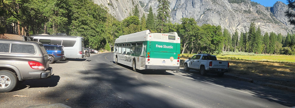
Lowlights: Shuttle busses whiz by every 20 minutes or so during the summer creating some road noise, but that can be easily overlooked given the relaxing setting. During the heat of the summer, it can get hot and dusty.

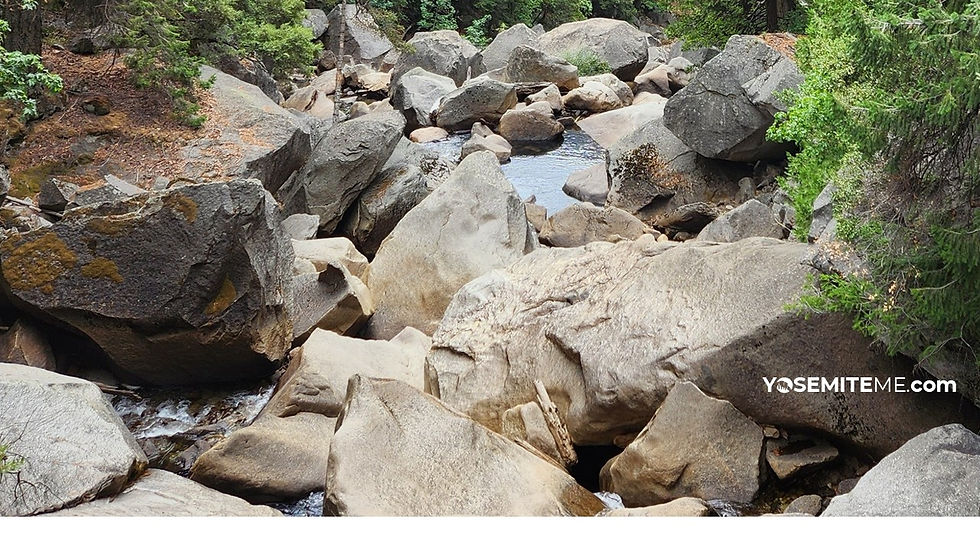
CASCADES (Ranking = 3.9)


Highlights: The Cascades Picnic Area is a picturesque stopping point along the Merced River 2.8 miles from the western entrance to Yosemite (also called the Arch Rock or Highway 140 entrance). The Cascades Picnic Area can be found on the right-hand side of the road, one block before the Cascades viewing area while driving toward Yosemite Valley.
Most people zoom by this picnic area since they have likely waited in a long line to get into the Park and wish to get to their primary destination as soon as possible. Consequently, the crowd factor can be minimal, making for a restful stopping point among the pines. Sandy shores allow for wading into the Merced River and shady areas abound. Not a few have found this location an ideal spot to get married.
Not far from the picnic area can be found the Cascades Viewing Area parking lot (travel east toward Yosemite Valley for a block or so on the left-hand side of the road). This provides an extra adventure for those looking for sightseeing locations. A trail that takes visitors up to the base of the cascades/fall can be found by crossing over the bridge spanning the cascades, traveling up the road a little, and using the faint trail that leads away from the road. It will take you to the base of the cascades.

Lowlights: If you are coming from inside Yosemite, you almost have to leave the Park to get there.

WAWONA HISTORY CENTER (Ranking = 3.8)


Highlights: Visitors can find three different areas to picnic here at this popular stopping area in Wawona (near the South Entrance of Yosemite, Highway 41, just past the Wawona Hotel). The first area includes three picnic tables and five grills near the market. It can get dusty here during the summer and shade can be lacking. The second area is between the outdoor bathrooms and the covered bridge under low-lying trees that provide lots of shade. Five picnic tables are available here. Finally, across Forest Drive and nearer the banks of the South Fork of the Merced River, nine tables and five grills can be used by visitors. Shade can be found by afternoon. This picnic area can provide the perfect “filling station” for travelers that have been driving for hours. Restrooms are available along with a small market, a gift shop, and a gas station. Activities can also be found at the Wawona Hotel nearby. Recently installed electric vehicle charging stations can also be accessed.

Lowlights: Since it is near the southern Yosemite entrance, lots of cars, trucks, and buses pass along the road headed toward the Valley. The bathrooms can also be well-used during the summer with lines forming frequently. Swimming in the Merced River near here is not recommended due to the steep and rocky banks. Better swimming holes exist on Chilnualna Road near North Wawona. Wildlife avoids this area due to the high human presence. Although lovely in the evening and morning, the site can be hot during midday in the summer.

WAWONA CAMPGROUND SOUTH (Ranking = 3.6)


Highlights: This picnic area is relatively unknown and is oddly situated between the Wawona Campground and the picnic areas near the Wawona History Center noted above. Nevertheless, its four tables can provide an emergency stopping point near the Merced River although this section of the river does not provide an area for swimming.

Lowlights: This picnic area is close to the busy Wawona Road. The toilet is also exposed to the sun, bringing some discomfort during the hot summers in Wawona. Additionally, the pit toilet shares close proximity with the picnic area. Aside from emergency use, the picnic areas near the Wawona History Center (less than a mile away) provide more comfort than this spot.

EL CAPITAN (Ranking = 3.5)


Highlights: With 18 tables, this picnic site can accommodate many picnickers. That is good in February because it becomes one of the prime areas overrun by photographers trying to capture a photo of Horsetail Fall during its brilliant winter glow. Naturally, views of El Capitan are nearby. The site can also be reached by a shuttle bus making it a decent destination for a picnic and exploring the west end of Yosemite Valley. It is 2.5 miles from Yosemite Village so, although there may be few people present at times, it can serve as day-use parking for those desperate to find a spot to park in the Valley. It sits among a mixed forest with black oak, cedar, and ponderosa pine just off of Northside Drive. Picnic tables are generally shaded depending on the time of day. Still, it can be hot during the summer.
Lowlights: A high presence of bugs can be found early in the morning. Additionally, since it is a shuttle stop, a bus will storm through the parking lot about every 20 minutes during the summer. Its distance from Yosemite Village and being positioned on the way out of Yosemite Valley (2.5 miles from the main Yosemite Valley parking area, i.e., Yosemite Village) makes it serve better as a last-ditch effort to find day-use parking.


MARIPOSA GROVE (Ranking = 3.5)


Highlights: The Mariposa Grove Picnic Area is located on the Mariposa Grove Road between the Mariposa Grove Welcome Plaza and the Grove. It can only be accessed by automobile for those who have a handicapped parking sticker and those who hike the Washburn Trail, which starts at the Welcome Plaza parking lot. The trail is an alternate route to the Grove and trail signs will direct you to the picnic area. Additionally, from December to March, the Mariposa Grove Road closes to vehicles, and the shuttle does not operate during this time. The road does remain open to hikers, snowshoers, and skiers.
Lowlights: The picnic area’s limited access reduces its functionality for the Mariposa Grove hiker. If you travel to the Grove during winter along the Mariposa Grove Road, the bathrooms may prove to be useful. Otherwise, comfort stations are offered at the Grove and seating for a lunch is available.

LEMBERT DOME (Ranking = 3.2)


Highlights: Lembert Dome Picnic Area rests at the east end of Tuolumne Meadows off of Tioga Road, making it a convenient spot to stop before taking advantage of trails that start near the parking lot. Most notably, the Lembert Dome and the Dog Lake Trails, both 2.8 miles round-trip, are the locations top draws. To reach the picnic area, which spans the eastern edge of the parking area, make a left on to Yosemite National Park Road after passing Tuolumne Meadows going east and make a quick right into the parking lot.
Lowlights: Convenient spells crowded in this neck of the Park. The parking lot serves as a perfect spot to park for the trailheads in the area. Additionally, the toilets offer one of the few parking/toilet combination so lines can form for the pit toilets in the summer. Unfortunately, a few picnic tables are downwind from the toilets and eating at these tables can be unappetizing. The other picnic tables fringe the parking lot and take the full brunt of the sun, making this spot somewhat undesirable given the placement of the amenities.


Comments